This content refers to the previous stable release of PyMVPA.
Please visit
www.pymvpa.org for the most
recent version of PyMVPA and its documentation.
atlases.base
Module: atlases.base
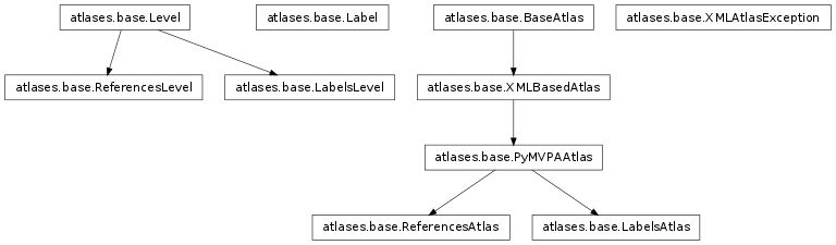
Inheritance diagram for mvpa.atlases.base:
Base classes for Anatomy atlases support
TODOs:
- major optimization. Now code is sloppy and slow – plenty of checks etc
Module Organization
mvpa.atlases.base module contains support for various atlases
| group Base: | BaseAtlas XMLBasedAtlas Label Level LabelsLevel |
|---|
| group Talairach: |
|---|
| | PyMVPAAtlas LabelsAtlas ReferencesAtlas |
| group Exceptions: |
|---|
| | XMLAtlasException |
Classes
-
class mvpa.atlases.base.BaseAtlas
Bases: object
Base class for the atlases.
Create an atlas object based on the... XXX
-
class mvpa.atlases.base.Label(text, abbr=None, coord=(None, None, None), count=0, index=0)
Bases: object
Represents a label. Just to bring all relevant information together
| Parameters: |
- text (basestring) – fullname of the label
- abbr (basestring) – abbreviated name (optional)
- coord (tuple of float) – coordinates (optional)
- count (int) – count of those labels in the atlas (optional)
|
|---|
-
abbr
Returns abbreviated version if such is available
-
coord
-
count
-
static generateFromXML(Elabel)
-
index
-
text
-
class mvpa.atlases.base.LabelsAtlas(*args, **kwargs)
Bases: mvpa.atlases.base.PyMVPAAtlas
Atlas which provides labels for the given coordinate
See also
Please refer to the documentation of the base class for more information:
PyMVPAAtlas
Initialize instance of PyMVPAAtlas
| Parameters: |
- filename (string) – Filename for the xml definition of the atlas
- resolution (None or float) – Some atlases link to multiple images at different
resolutions. if None – best resolution is selected
using 0th dimension resolution
- image_file (None or str) – If None, overrides filename for the used imagefile, so
it could load a custom (re-registered) atlas maps
- query_voxel (bool) – By default [x,y,z] assumes coordinates in space, but if
query_voxel is True, they are assumed to be voxel coordinates
- coordT – Optional transformation to apply first
- levels (None or slice or list of int) – What levels by default to operate on
|
|---|
-
labelVoxel(c, levels=None)
Return labels for the given voxel at specified levels specified by index
-
class mvpa.atlases.base.LabelsLevel(description, index=None, labels=[])
Bases: mvpa.atlases.base.Level
Level of labels.
XXX extend
-
find(target, unique=True)
Return labels descr of which matches the string
| Parameters: |
- target (str or re._pattern_type) – Substring in abbreviation to be searched for, or compiled
regular expression to be searched or matched if anchored.
- unique (bool) – If True, raise exception if none or more than 1 was found. Return
just a single item if found (not list).
|
|---|
-
static generateFromXML(Elevel, levelIndex=[0])
-
index
-
labels
-
class mvpa.atlases.base.Level(description)
Bases: object
Represents a level. Just to bring all relevant information together
-
static generateFromXML(Elevel, levelType=None)
Simple factory of levels
-
levelType
-
class mvpa.atlases.base.PyMVPAAtlas(*args, **kwargs)
Bases: mvpa.atlases.base.XMLBasedAtlas
Base class for PyMVPA atlases, such as LabelsAtlas and ReferenceAtlas
See also
Please refer to the documentation of the base class for more information:
XMLBasedAtlas
Initialize instance of PyMVPAAtlas
| Parameters: |
- filename (string) – Filename for the xml definition of the atlas
- resolution (None or float) – Some atlases link to multiple images at different
resolutions. if None – best resolution is selected
using 0th dimension resolution
- image_file (None or str) – If None, overrides filename for the used imagefile, so
it could load a custom (re-registered) atlas maps
- query_voxel (bool) – By default [x,y,z] assumes coordinates in space, but if
query_voxel is True, they are assumed to be voxel coordinates
- coordT – Optional transformation to apply first
- levels (None or slice or list of int) – What levels by default to operate on
|
|---|
-
Nlevels
-
source = 'PyMVPA'
-
space
-
spaceFlavor
-
class mvpa.atlases.base.ReferencesAtlas(distance=0, *args, **kwargs)
Bases: mvpa.atlases.base.PyMVPAAtlas
Atlas which provides references to the other atlases.
Example: the atlas which has references to the closest points
(closest Gray, etc) in another atlas.
See also
Please refer to the documentation of the base class for more information:
PyMVPAAtlas
Initialize ReferencesAtlas
| Parameters: |
- filename (string) – Filename for the xml definition of the atlas
- resolution (None or float) – Some atlases link to multiple images at different
resolutions. if None – best resolution is selected
using 0th dimension resolution
- image_file (None or str) – If None, overrides filename for the used imagefile, so
it could load a custom (re-registered) atlas maps
- query_voxel (bool) – By default [x,y,z] assumes coordinates in space, but if
query_voxel is True, they are assumed to be voxel coordinates
- coordT – Optional transformation to apply first
- levels (None or slice or list of int) – What levels by default to operate on
|
|---|
-
distance
-
labelVoxel(c, levels=None)
-
levelsListing()
-
setDistance(distance)
Set desired maximal distance for the reference
-
setReferenceLevel(level)
Set the level which will be queried
-
class mvpa.atlases.base.ReferencesLevel(description, indexes=[])
Bases: mvpa.atlases.base.Level
Level which carries reference points
-
static generateFromXML(Elevel)
-
indexes
-
class mvpa.atlases.base.XMLAtlasException(msg='')
Bases: exceptions.Exception
Exception to be thrown if smth goes wrong dealing with XML based atlas
-
class mvpa.atlases.base.XMLBasedAtlas(filename=None, resolution=None, image_file=None, query_voxel=False, coordT=None, levels=None)
Bases: mvpa.atlases.base.BaseAtlas
| Parameters: |
- filename (string) – Filename for the xml definition of the atlas
- resolution (None or float) – Some atlases link to multiple images at different
resolutions. if None – best resolution is selected
using 0th dimension resolution
- image_file (None or str) – If None, overrides filename for the used imagefile, so
it could load a custom (re-registered) atlas maps
- query_voxel (bool) – By default [x,y,z] assumes coordinates in space, but if
query_voxel is True, they are assumed to be voxel coordinates
- coordT – Optional transformation to apply first
- levels (None or slice or list of int) – What levels by default to operate on
|
|---|
-
coordT
-
extent
-
labelPoint(coord, levels=None)
Return labels for the given spatial point at specified levels
Function takes care about first transforming the point into
the voxel space
| Parameters: |
- coord (tuple) – Coordinates of the point (xyz)
- levels (None or list of int) – At what levels to return the results
|
|---|
-
levelsListing()
-
levels_dict
-
loadAtlas(filename)
-
origin
-
setCoordT(coordT)
Set coordT transformation.
spaceT needs to be adjusted since we glob those two
transformations together
-
spaceT
-
version
-
voxdim
Function
-
mvpa.atlases.base.checkRange(coord, range)
Check if coordinates are within range (0,0,0) - (range)
Return True on success